As part of Sheffield’s Better Buses programme, the Rutland Road/Pitsmoor Road and Rutland Road/Cooks Wood Road junctions have been identified as causing delays. The council’s reports are available here, and the full design is here. The junctions are next to each other, Google map link with Streetview.
“Buses are delayed due to congestion, and limited road width, along Pitsmoor Road.”
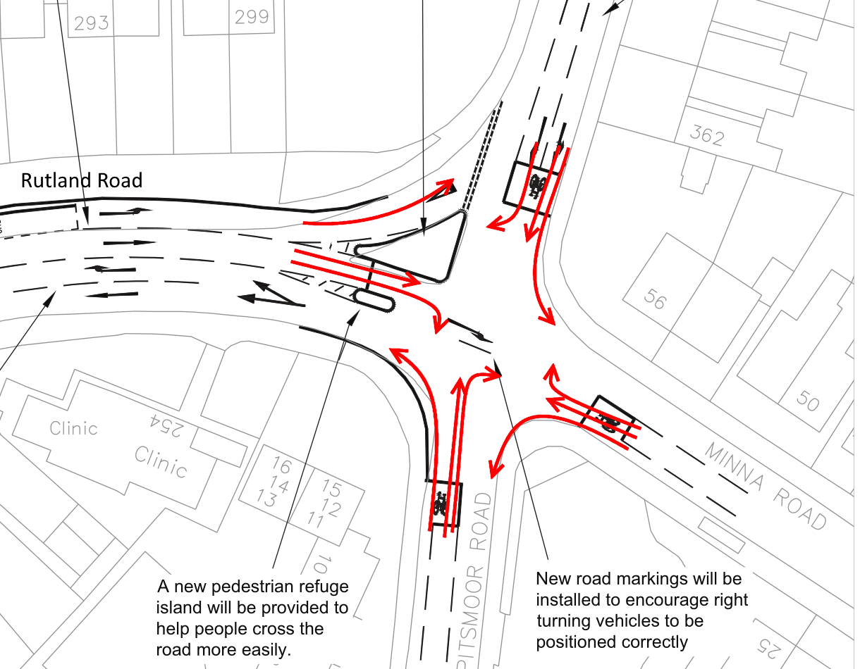
The solution is “a scheme to address the delays, which comprises road widening, revised road markings and a new pedestrian crossing point”, costing “around £300,000 which includes for design, construction, supervision, contingency and commuted sum. It is to be funded from the Passenger Transport Executive’s 2016/17 Better Buses programme”.
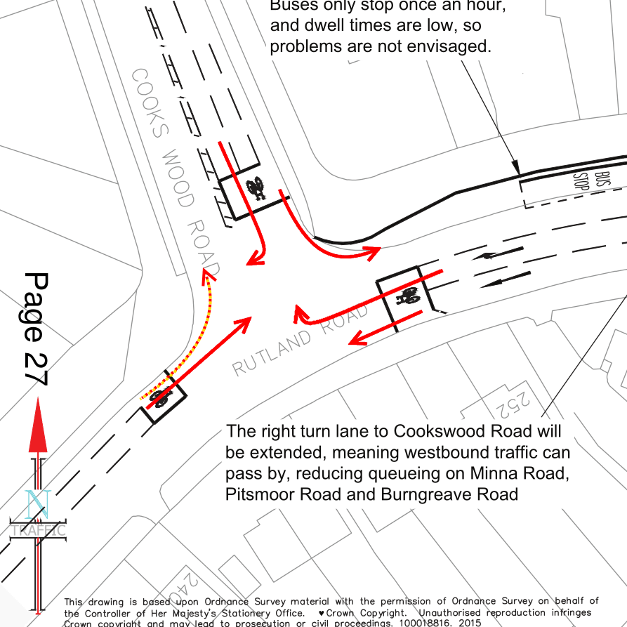
The fundamental problem is that the right turn lane into Cooks Wood Road from Pitsmoor Road is of insufficient capacity to cater for the number of vehicles. Consequently this queue blocks other movements and causes delays. The scheme addresses this by widening the carriageway on the northern side of Rutland Road, allowing the right turn lane to be extended. Pedestrians also have difficulties crossing at the junction, so a new refuge island is to be provided to offer better crossing opportunities without causing undue delays to traffic.
“Without causing undue delays to traffic”, says it all really, happy to do anything, unless it delays traffic, and by traffic, they mean motor traffic. Putting aside the problem with widening the road to ease congestion in the name of bus improvements… I’ve tried to assess this design using the London Cycling Level of Service junction tool (page 14/15) to see what it means for cycling.
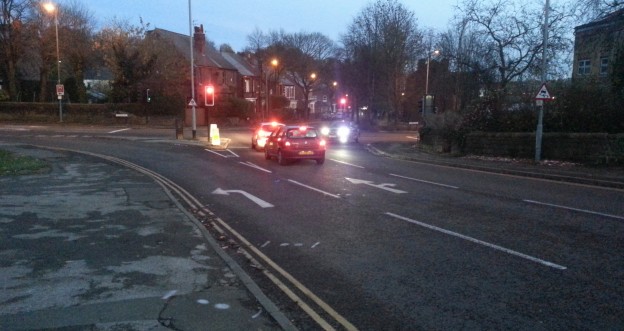
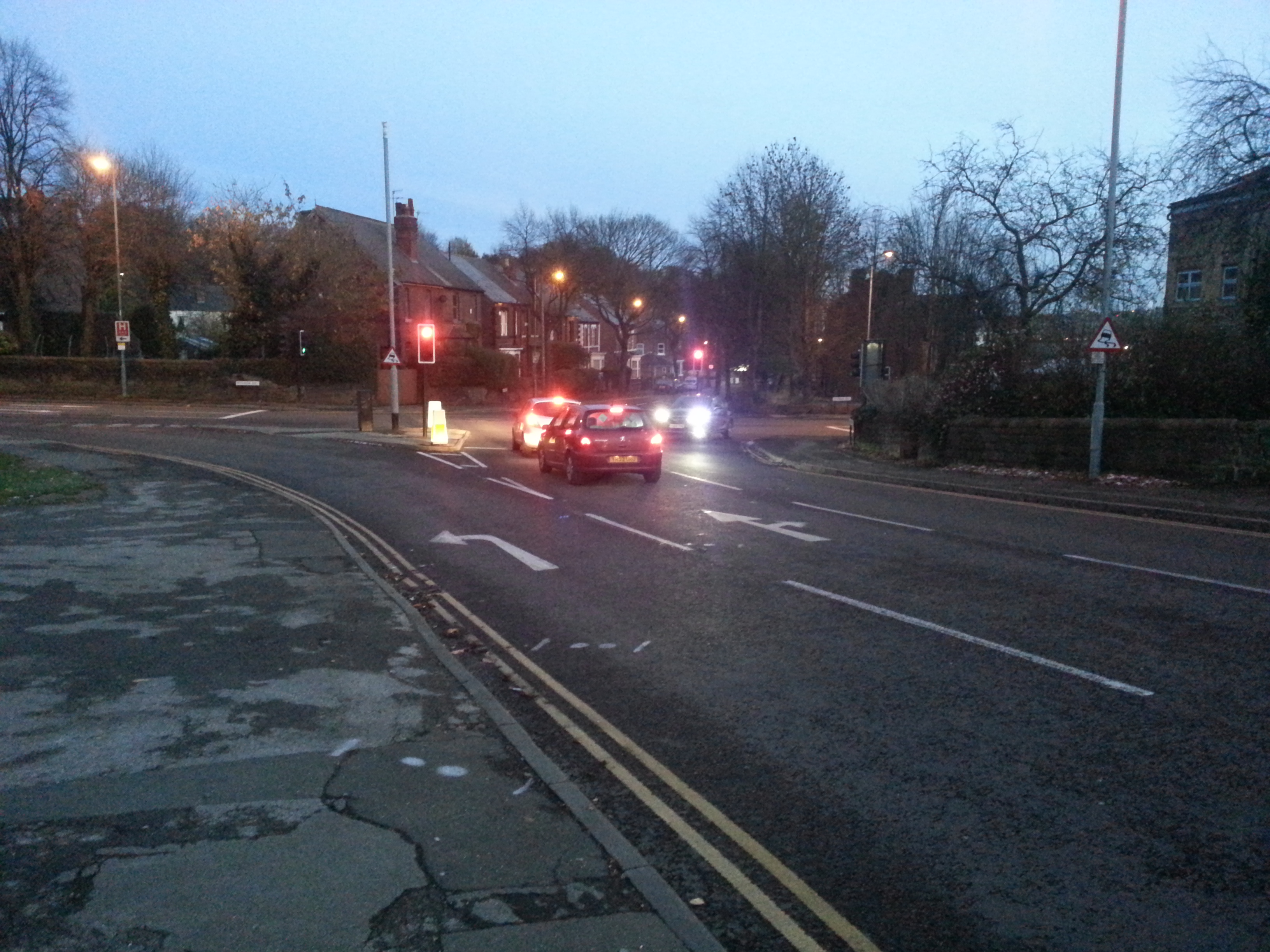
Every motor traffic movement is signal controlled. There is no protected space for cycling, there are no cycle specific signal stages, and there are no signal controlled pedestrian crossings. Speed limits are 30mph and traffic volumes are about 1,325 motor vehicles per hour (16:00 on Saturday afternoon) on Rutland Road, with higher numbers on Pitsmoor Road.
Rutland Road/Cooks Wood Road T-Junction- Score 0 out of 12
The volume of traffic (at 16:00 on a Saturday) is 1,325 motor vehicles per hour, >1000 vph is the critical failure threshold (at peak, and where cyclists are not separated).
Travelling from Rutland Road South, there is a 5m deep advanced stop line with a 1.5m cycle lane leading into it, but there’s no cycle infrastructure continuing into the junction. The left turn into Cooks Wood Road isn’t protected at all. Going straight on Rutland Road, the cycle lane doesn’t continue across the junction and there is no protection from left turning traffic (approximately 1/3 of traffic). Both of these movements score 0, but it’s possible that the left turn should score 1.
Travelling from Rutland Road North, there is a 5m deep advanced stop line, but no cycle lane leading into it. There are two lanes, a straight on and a right turn. Going straight on, there are no cycle facilities and there is a pinch point 3.9m wide (width of 3.2-4.0m should be avoided). Turning right cyclists have to move into the outside lane with no protection and then don’t have any protection through the junction and there is oncoming traffic. Both of these movements score zero because of pinch points, speed of traffic, volume of traffic, multiple lanes and oncoming traffic when turning right.
Travelling from Cooks Wood Road there is a 5m deep ASL, with a 1.5m feeder lane, the road has two lanes of traffic, one for left and one for right. Making the left turn, there is no protection from left turning traffic and the ASL feeder lane begins beyond the start of the traffic queue. Turning right, cyclists have to move into the outside lane, there is no protection in the junction and a pinch point of 3.9m on the exit of the junction. Both of these movements score zero.
6 Movements, all scoring 0, out of a total score of 12.
Rutland Road/Pitsmoor Road Crossroads – Score 0 out of 24
Travelling from Rutland Road, there are two lanes, one left (a sliplane), one combined straight on and right, there is no ASLs and no cycle facilities. All of these movements score zero, left turn because of the left turn slip lane, straight on because of the need to move out into the outside lane to use the junction and because of the lack of separation, and the right turn for the same reason with the added risk of having to sit in the middle of the junction with traffic passing on the left going straight ahead, and oncoming traffic on your right.
Travelling from Pitsmoor Road South, there is a 1.5m wide feeder lane to a 5m deep ASL. There is a single general traffic lane. The speed limit is 30mph and there are > 1000vph, a critical failure. Turning left, the radius is being increased, there’s no dedicated space in the junction for cycling. Going straight on, there is no protection from left turning traffic and there will be conflict with vehicles trying to overtake cycles while oncoming vehicles are waiting to turn right into Rutland Road. There is no dedicated space for cycling in the junction. Turning right, you will have to wait in the middle of the junction with traffic passing on your left, as well as oncoming traffic. All of these movements score zero.
Travelling from Pitsmoor Road North, there is a 5m deep ASL with no cycle lane or feeder lane. The speed limit is 30mph and there are >1000vhp. There are two lanes, a combined straight on and left and a right turn lane. Turning left, there is no dedicated space for cycling, no protection and a large junction radii. Cycling straight on, there is no protection from left turning traffic and no dedicated space for cycling through the junction. Turning right, cyclists need to move into the outside lane and wait in the middle of the junction for a gap. All of these movements score zero.
Travelling from Minna Road from the east, the story is the same. Speed limits are 30mph but I don’t know the volume of the traffic. There is a 5m deep ASL with a 1.5m feeder lane. Turning left, there is no dedicated space for cycling. Going straight on, there is no protection from left turning traffic or dedicated space for cycling. And turning right, there will be a need to wait in the middle of the junction with traffic on both sides. All of these movements score zero.
So, a scheme that scores zero (possibly one) out of 30. Not great. We’ve got to up our game in Sheffield if we’re ever to get to 10% of journeys made by bike in 10 years. Feedback on how I’ve applied the LCDS tool is more than welcome, especially if you think I’ve missed anything or given any movements incorrect scores.
Sheffield. Spending money to increase motor traffic capacity on roads next to our outdoor attractions #outdoorcity pic.twitter.com/ITbuf69tQ7
— Matt Turner (@MattTurnerSheff) November 18, 2015